v2 - Intelligence-Forward
Segment One
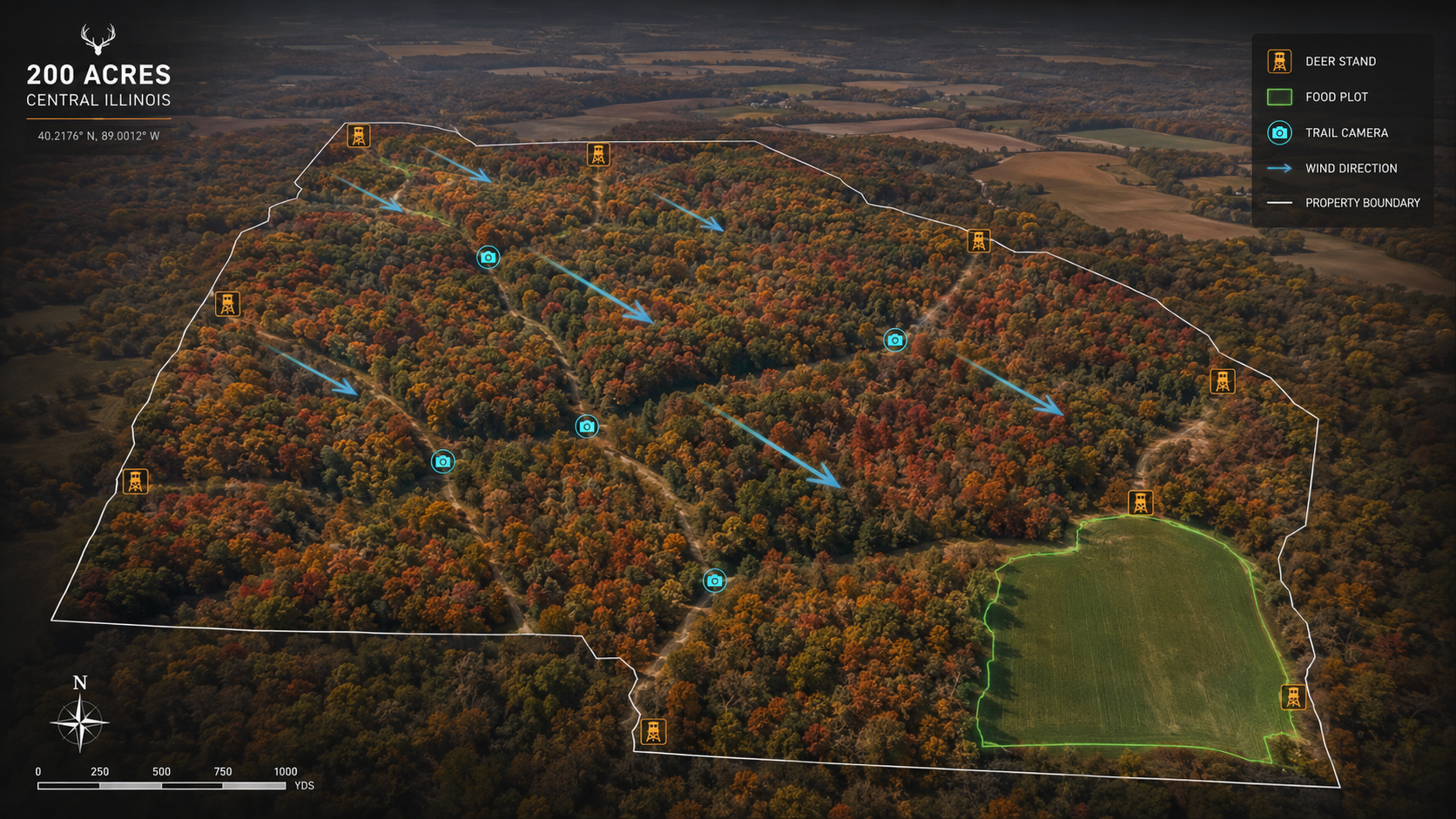
Farm + Hunting
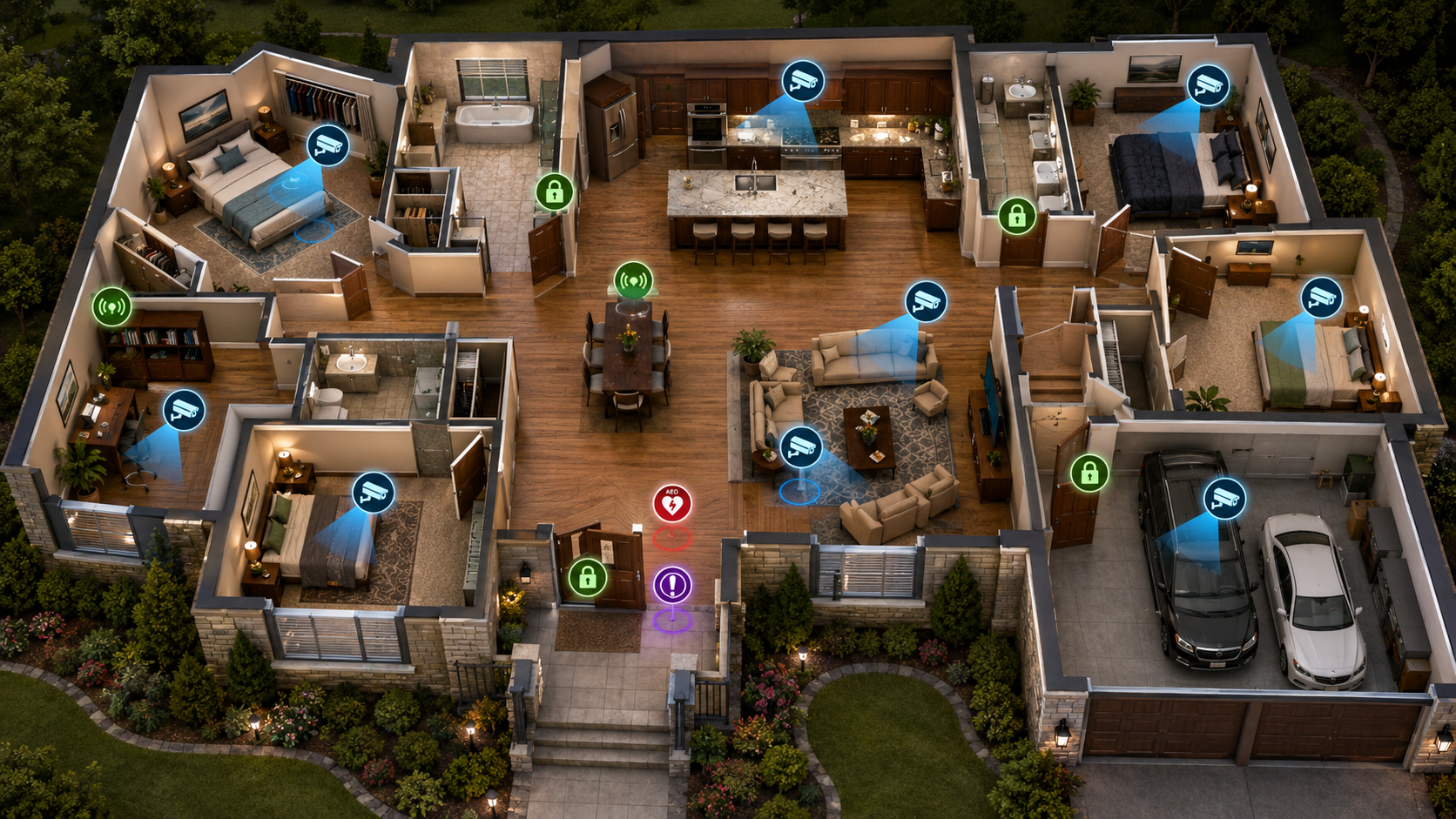
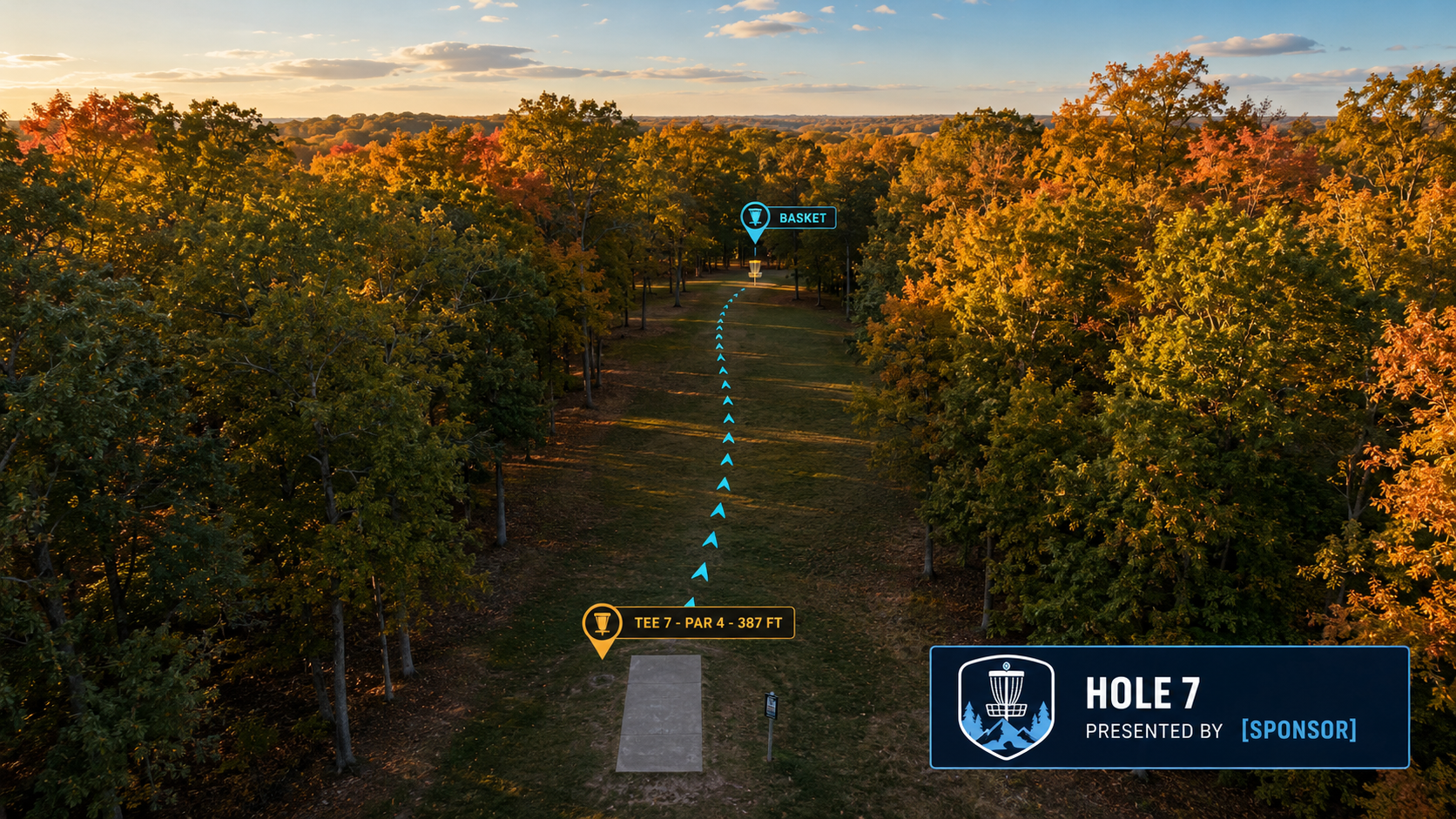
Pre-mission briefings for high-dollar outfitters running guided hunts as professional operations. Drone mesh fused with USGS, FEMA, NOAA, USDA, trail-cam, and tactical hunting overlays.
View flyer ->